VFR/IFR charts: FAA via VFRMap · live traffic via adsb.fi · METAR via aviationweather.gov · imagery © Esri
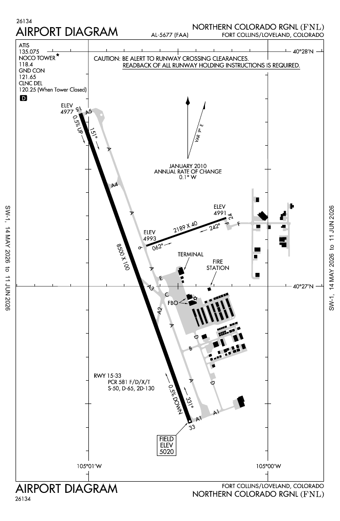
Northern Colorado Regional
KFNL · FNL · Fort Collins-Loveland, CO
METAR loading…
Remote tower in SDA · temporary mobile tower in use verify
Original FAA non-federal Remote Tower pilot site (CDOT-sponsored). One of the first U.S. attempts at a fully remote-controlled tower.
Sponsor
CDOT + Northern Colorado Regional
Now operating
Temporary mobile tower
SDA team
Raytheon/Collins + Frequentis verify
Runways
15/33 ~8,500 ft; 06/24 verify
Elevation
~5,016 ft verify
Coordinates
40.4518, -105.0114
Project timeline
2017
Searidge selected as RTS vendor (CDOT/FAA pilot)
2023
Searidge withdraws; project in limbo
2023–24
Raytheon/Collins + Frequentis pick it up; testing at ACY verify
late 2025 / early 2026
Targeted System Design Approval (SDA) verify
after SDA
Commissioning & remote operations
Frequencies
118.400NoCo Tower / CTAF (lights after hrs)audio
News · FNL remote tower
Auto-updated by the news bot on tags: FNL, KFNL, Fort Collins, Loveland, Northern Colorado, NoCo.
Layers toggle (top-left): VFR sectional / IFR low / IFR high over satellite. Live ADS-B refreshes every 12s; click an aircraft for details. Fields marked verify pending confirmation.